Showing posts with label outdoors. Show all posts

Wednesday, September 22, 2010

Sufferfest 2010

Last summer, after an amazing few days in the Glacier Peak Wilderness, Andrew and I decided to return in 2010 for a week-long end-of-summer hike-a-thon. Our planned route was over Little Giant Pass to the Napeequa Valley, west to the PCT where we would go over Indian pass and take the "closed" portion of the PCT up to Image Lake, and return over Spider Gap. A 100 mile loop around one of our favorite Washington peaks. I put in the request for days off from work the required six months in advance, and we planned, dehydrated food, and studied maps.

Seattle weather before the trip was not promising: the rainiest September of memory. We drew out a pros and cons list for alternate options. After hours of contemplation, debating, and discussion, we decided not to change our plans. Seattle weather be damned, we were headed to the Glacier Peak Wilderness.

We headed out, stopping by the 59'er diner for lunch (stackers!!). This afforded us full bellies, but also a late afternoon start time. Reaching the trailhead about three hours before dark we forded the Chiwawa river and headed up the overgrown and steep trail to Little Giant Pass.

Brendan's not-so-happy faces while fording the icy Chiwawa

From Glacier Peak Sufferfest


Hauling our bloated bodies up Little Giant Pass

From Glacier Peak Sufferfest


From our first night camp on top of Little Giant Pass

From Glacier Peak Sufferfest


Colder, wetter weather moved in during the night bringing a light dusting of snow and ominous clouds. We finished the climb over Little Giant and headed down to the Napeequa valley, throwing worried looks upwards to the little black rain clouds hovering overhead.

Short but sweet view through the clouds of Clark Mountain over the Napeequa Valley.

From Glacier Peak Sufferfest


From the Bottom of the Valley

From Glacier Peak Sufferfest


As we started our climb out of the Valley, the rain began. Tentatively at first, then in lusty drops that pockmarked our foreheads as we looked up in anticipation towards Boulder pass. The overgrown slide alder and huckleberry bushes acted as sponges, ready to loose their wet bounty at the most gentle brush or tap. The water off of the bushes rushed down our legs, and came to an abrupt standstill in our shoes as we squish-squashed up the trail.

Reaching higher elevations, the temperatures began dropping. Trickles, then cascades of water poured off gabled buttresses on Clark Peak and down the trail, which was now more of a streambed. We hurried downhill, hopeful to find a dry spot in the trees to pitch the tarp to wait out the rain, which now had taken on an air of malice.

And so it rained...for 23 hours. Rain on the tent, rain in our sleeping bags, rain on our dry clothes, rain in all body crevices. We attempted to ignore it, vainly picking wet pine needles out of our chili. Then we tried to bargin with it, hovering in the dryest quarter of the tent. We shouted at it, when drips through the leaky megamid kept us from sleep.

Finally, we accepted it and decided to bail. A little bit defeated, we made a dash for the nearest exit point when the rain let up. Luckily, we were able to hitch a ride to Lake Wenatchee where the locals were more than happy to take our money for a long, bumpy ride back to the car.

Headed back to Seattle I decided that I undoubtedly needed a little sunshine in my life...but where would this be found? Perhaps Oregon?

Only 50% drowned

From Glacier Peak Sufferfest

Friday, July 30, 2010

Blame It On The Tetons

Job perks:
1.) new smells daily
2.) decreased worry about planning what to do with my weekday evenings
3.) old-fashioned dirty medical stories to tell at dinner parties
4.) CME money and time

I decided to take advantage of perk #4 and head to Wyoming for some medical education and hiking. Although I was super excited about learning about "Safeguarding Sphincters" (an actual lecture title...which I can post on later if there are interested parties), I was a bit more excited about hiking the Teton Crest Trail, mountain biking, and sleeping on the ground for a week.

The wildflowers were still blooming, the days were sunny, the hitch-hiking was easy, the crest trail was relatively unpopulated, and the company was great. I'm proud to say that I now officially have hiking-in-Chacos tan lines.

Queen Anne's Lace


View of the Teton range from Death Canyon Shelf.


Wildflowers blooming


Say Hello to my little friend


Views from Alaska Basin


From Hurricane pass


The reason I carried a large, heavy camera for the trip


The Grand, shrouded in clouds, on a day not for climbing. The week before we were there 16 climbers were rescued after being caught in a morning Thunderstorm


Attempt at self portrait


After finishing up the Crest Trail, Andrew and I left Jackson Hole to do some hiking in the Wind River Range. We stopped in Pinedale for coffee, pancakes as big (and delicious) as your right ass cheek, and a large earful of boomtown politics.

Seated near some local ranchers, now making their fortune off of natural gas, breakfast quickly became a quiet affair. We sat and listened to stories of apocalyptic planning, where not to go in California (south or west of Bakersfield), how to spend your fortune on mail order precious metals, what women are good for, and how Mexico is a bastion of free speech and individual freedom (and apparently where to move if Obama is elected for another term). Sometimes you just have to eavesdrop.

The Winds were beautiful, and had an untamed feeling that you don't get in the National Parks. I want to return with a fishing pole and a pack full of rice and butter for a few weeks of backcountry wandering and trout eating. I want to do this wandering when the mosquitoes have less of a voracious appetite...or maybe with a complete body suit of netting.

Green River Lakes


Crazy lichen


The canyon and another phallic object

Friday, April 23, 2010

Four days in the Glacier Peak Wilderness

Glacier Peak is the wilderness volcano. It lies 10 miles as the crow flies from any road, and ever further as the homo sapien walks. It doesn't dominate the skyline like Rainier does in Auburn, or Baker does from Burlington, but on a clear day on the bridges in Seattle, look east and it'll be there gleaming white. It occupies a lofty piece of sky from Cascade Pass, Buck Creek Pass, the Alpine Lakes: some of my favorite places in the cascades.

A late start from Seattle Friday afternoon dashed our hopes of getting beyond the Mackinaw shelter that night. Views behind us to Sloan distracted us from the hard work of carrying skis and boots and winter gear along the dry trail. Once we got to the shelter, we stayed up late attempting to keep the campfire burning, mistakenly believing the next day would be an easy one.


Reaching continuous snow the following morning was cause for celebration. The late winter sun warmed us as we changed into boots and crampons. The sun was also rapidly warming the south-facing slope we need to climb, we soon realized, as we occasionally sunk through the 190-pound crust and resorted to the time-tested "alpine wallow" to climb out of tree wells.

We finally made it to a bench, changed to skins and nervously eyed the headwall above. After much debate, we skinned east across the bench, including one sizeable pile of fresh-looking avy debris and aimed for a steep, treed rib that offered some protection before it petered to steep, open slopes until the angle mellowed out towards the top.

Meandering along a ridge towards White Mountain, we were not quite sure how we were going to enter the White Chuck drainage, since the north side of the ridge was steep and corniced, until a promisingly-looking gap in the cornice appeared, leading down into the White Chuck basin and a series of bowls and benches. Night quickly fell as we made camp in a stand of trees.


The next morning we left after daybreak, but long before the sun had climbed over the ridge to warm us. We followed drainages up and across a glacial plateau, then crossed a broad col before finally arriving at the foot of Glacier, several hours later. The summit was still a humbling-distance away. We followed a wandering ridge a ways, then dropped onto the Gerdine Glacier and made a rising traverse to the east. We reached the Gerdine-Cool Col as the sun was diving back below the ridge, left with neither time nor energy to go any higher. To the south lay Daniels, Hinman, Overcoat and Chimney and eventually Rainier. To the west, the Olympics poked through. To the southeast, the Dakobed, cloaked in white poked up craggily. We skied variable snow: from soft sastrugified windpack to shallow powder to gently-breakable crust, then reversed the long, rolling traverse back to camp.


Monday morning, we struck camp and skinned back south towards the notch in White Mountain's corniced ridge, arriving before noon to slightly-undercooked corn. We made a few turns here and there and mainly traversed west on the steep (45 degrees in places) slope on the tasty corn snow. Below a couple hundred vertical feet of truly-atrocious breakable crust transitioned to stable, summertime corn, which we skied through increasingly-dense slide alder to 3300 feet, where we encountered the snow-covered trail.

Glacier was now hidden behind the ridge. But I could feel it looming invisible, impassive, above me as I shouldered my skis and hiked out.

Sunday, November 29, 2009

Elfin Lakes, British Columbia

We drove up a little past Squamish to the Diamond Head sector of Garibaldi Provincial Park. Snow conditions were initially crummy.


But there was this bright glowing orb in the sky and the Coast Range was out in all her glory.


We managed to finish the 11 km approach right as darkness swallowed us. The hut was even more deluxe than I had imagined, with gas light and heat, and we only had to share it with three other guys and two mice. The following day, I tagged along with some good ol' boys from Squamish and skied off of Columnar Peak. Over night six or seven inches of light and tasty snow had fallen. In the open, if you kept up your speed it was quite nice, but in the trees or in tighter terrain, the bumpy and runneled crust made skiing unpleasant. And needless to say, the visibility had taken a turn for the worse.


I acted (in my opinion) responsibly and prioritized a daylight return to the car over taking another lap off Columnar. It was still a bit of a slow, wet affair out of the hut. I can't wait to go back.

Sunday, August 9, 2009

26 Hours in the Boston Basin

We have been ascending for hours. Glances back to the north face of Johannesburg mountain, once towering above us and now at eye level, are a consolation. Now we need to stop and put on our harnesses. We gain a notch beside a decaying tower of rock and sit down. It is mid-morning, warm and windless. The sun makes me sleepy. I drift off for a few minutes before Mike, clinking hardware, draws me unwillingly back into consciousness. I glance at the route description and artfully offer to lead the first pitch to avoid leading the crux.


A few hours and a few pitches later, I am leading again. The ridge narrows to a sharp edge. I gingerly traverse, stick in a cam, and pause with a sinking feeling as I eye the next fin ahead. It is nearly vertical, six or seven feet long, and doesn't have even so much as the edge of a dime to step on. I look down, horrified at the abyss yawning beneath. I glance over to the north side, and see a rubble-strewn ledge system running four or five feet below the crest. Shit, that doesn't look enticing, either. I dither for a few more minutes and fantasize about large birds plucking me from my airy, unwilling perch and gliding with me to flat ground. I order my freaked-out brain to commit. It is much easier than it looked, but I'm gripped by the time I make my way across some sloping ledges a bit below the crest. I think I want my mom.


The next few pitches go slowly and it is now late afternoon. We come to the edge of an abrupt tower and rappel into a notch stacked with blocks of dark, lichen-covered rock. Above us, another stark tower of rock, variegated with water stains, guards passage to the summit. From the looks of it, this is the crux. Mike leads out, takes a few minutes to arrange a couple cams and suss out the moves, and then disappears over the top of the bulge. I feed out rope steadily for a while, then in fits and spurts, then stop.


I look down. Far below me, to my right, the immense Boston Glacier is now in shadow. Its crevasses are now black, the snow, blue. On my left, some final-looking rays of sunlight color the basin. The only human presence I see is a tent, three thousand feet below, in a stunted stand of avalanche-flagged pines. It is hopelessly removed and impossibly small.

I feel impossibly small, a trespasser sitting on this broken ridge. I shiver a bit and turn more of my body into the sun as a chill settles on the evening. At my feet, a clump of cobalt flowers flutters in the breeze, also seeming to shiver. The sun gets me drowsy and through the slits of my eyelids I see a fat bumblebee settle on one of the flowers at my feet. The bee doesn't care that it's on an inhospitable fin of rock thousands of feet above the nearest tree, just as the rock doesn't care that two humans are scrabbling across its spine. It seems inhuman, but beautiful. It makes me want to cry. A tug on the end of the rope startles me out of my existential reverie and I break down the anchor and start climbing.

It's a while still before we are standing on the summit. By now it is obvious that we will be chasing twilight off the mountain. Mike arrives, and we flee for our packs. Rappelling off of the north side of the mountain, further away from any road, only deepens the feeling of isolation. As the dusk deepens, we make our way along grassy ledges and look for passages across rocky ribs. It's dark by the time we find the gully that leads back to the civilized side of the ridge and up to our packs.


Back at our packs we exchange relieved high-fives. We descend by headlamp into the dark. A yellow moon is creeping above the horizon, but it is still hard to make out the buttress that guided us up this morning. We stand above an unfamiliar gully: noisy, with water pouring over drop-offs. I eye it dubiously and follow Mike. This is not the one we want. I dislodge a pile of rocks onto Mike as I claw my way back up to the flat spot above the gully. Hearts racing, we sit in the darkness, which is just as warm and windless as it was 12 hours before.

We try several variations on this theme before we locate the correct gully and slowly follow it back to the lower basin. By now the moon is diving towards the hazy western horizon. Some stumbling around in the dark later, we find the trail and follow it back towards the trees. The forest moths are startled by the strange blue orbs our headlamps cast, and flutter dizzily around our faces. Slippery roots blend into the dusty forest debris that conceals the tread. An hour later, I bid Mike goodnight and crawl off the trail. A man-shaped depression between two trees cradles me. I turn off my headlamp. The darkness is complete. I do not dream.

It's light out when the chill wakes me. I continue down the trail. Back at the car, Johannesburg once again towers above, its hanging glaciers cast blue by the diffuse light of dawn. Another team is preparing to head up.

Sunday, July 5, 2009

Hidden Lake Peak, North Cascades

Washington and I are a few months shy of the two-year mark. And while I have been enjoying my time in the outdoors of the great Northwest, somehow I have never made it to North Cascades National Park. The shame! The folly! I really am sorry it took so long.

Growing up less than 20 minutes from the start of the AT, the Appalachians were my first love. I have a habit of subconsciously comparing all other mountains to my well-known, pastoral hills of the Appalachians. There is this weird family tree of mountain organization in my mind, and every time I am introduced to a new mountain group, along comes a new label. The Appalachians are the old grandmother who has seen it all, with face full of smooth laugh lines, and plenty of laid-back wisdom: disciplining, but never too harsh. The North Cascades definitely fill the rebel distant cousin role. Rugged, dangerous. The whole family is always talking about his crazy ramblings. Probably a heart breaker with his good looks. You never know, he might try to kill you with a broken beer bottle or befriend you and have the greatest adventures of your life.

We hit the road on Friday afternoon to be stuck in the city-escaping traffic of the holiday weekend. Stop-n-going it until well out of Seattle, we were finally able to escape the highway to the stretch of cities ending in -ington, then to the North Cascades Highway, and finally to the trailhead for Hidden Lake Peak.

The trail was heavily wooded for the first 800 feet, but then broke out into a drainage, where it climbed steadily through areas of wildflowers, tongues of avalanche debris, and snow-melt streams.

From Hidden Lake Lookout


At about 5500 feet the trail turned to snow. Breaking out boots and ice axe, we kicked steps up to the ridge. We found the lookout on hidden lake peak just after the sun set behind Baker. As the sun was down, and I was a bit freaked out about crossing even slightly inclined frozen snow in the dark, I talked Andrew into a bivy on some snow-free ground at the top of the col. The sunset had been beautiful, with alpenglow lighting up peaks in every direction. From our bivy spot it was jagged, snow capped peaks for about 340 degrees around us. A perfect spot to sleep for the night.

From Hidden Lake Lookout


From Hidden Lake Lookout


...well, a perfect spot to sleep out except for the mosquitoes. We had been above tree line in solid snow for the last 1000 feet, and you think this would ensure a bug-free zone. But these mosquitoes if anything were worse up here than in the melted-out meadows below. Resigning to having at least two hundred bites by the morning, I fell into a deep sleep with a soundtrack of buzzing to my dreams.

Andrew with his own, personal swarm. Kind of like your own, personal Jesus, but a little less guilt when you kill them.
From Hidden Lake Lookout


My feelings towards the biting bugs
From Hidden Lake Lookout


We woke up to find that, in the light of day, the trail up to the lookout was melted out and an easy climb. So we climbed up to the lookout post, and spent some time taking in the views and reading journal entries from the lookout log. My favorite entry is from a girl who just was dumped for a "skinny girl in California", taking post-breakup haven in the mountains, and wishing her ex-boyfriend ugly children. Second favorite was a long entry about how the outdoor privy outside the lookout was, hands-down, one of the best views for pooping in the history of outdoor thrones.

Andrew reading journal entries in the lookout.
From Hidden Lake Lookout


Views from the breakfast table.
From Hidden Lake Lookout


We decided to start our descent about mid-day, after Andrew got in some turns. (Note to self: skis are a much faster downhill method of transportation than feet.)

From Hidden Lake Lookout


We hit the car in the late afternoon, and headed back to Seattle for some fireworks, crowds, and good, old-fashioned redcoat bashing. Don't get me wrong, fireworks and drunken crowds are great, but there is no greater way to celebrate Independence than in the woods on a mountain top.

Friday, June 19, 2009

Seven Lakes Basin, Olympic National Park

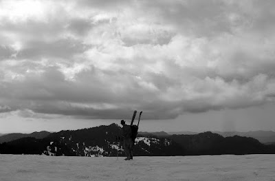
After landing in Seattle, I had two days of freedom before working a few shifts. We decided to hit up the Olympic Mountains. Olympic National Park is pretty diverse. It is a huge place with rain forests, a wild shoreline, snowy mountain vistas, and areas of thick ferned-n-mossed, rain-fed growth under a canopy of pines. Having seen the coast and rainforest, we wanted to head to the higher hills on this trip. It didn't end up to be all that we had hoped. The weather turned rainy, with clouds blocking any views, and the patchy snow and terrain made for not-so-great skiing conditions. So the days were spent hiking with a heavy pack and skis (for Andrew) and awkwardly slipping and post-holing (for me). Andrew did get in about 6 turns, and we made it back to Sol Duc hot springs about an hour before closing to soak in the sulfurous waters...so not a total loss.

Andrew looking over the Olympics to the North.
From Olympic National Park


Fun with shutter speeds
From Olympic National Park


Light at the end of the day
From Olympic National Park


Wishing the skis were on...
From Olympic National Park


Seven lakes basin
From Olympic National Park